|
In wilderness
above Borovnica
Spring time is full of rain and
sunshine. And because there is mud in abundance as well,
bikers like to stay on macadam roads at this time of the year.
OK, a short muddy section is bearable
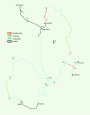
Starting point
Borovnica is a small town located at
the SW fringe of Ljubljana swampland (Ljubljansko barje).
It is 20 km away from Ljubljana, reachable either via Vrhnika
or Podpec.
Trail description
The trail goes along the hills
around Borovnica basin, where Pekel gorge reigns (Pekel =
hell). From Borovnica you ascent to the western edge of the
hills and then make a loop on the plateau, crossing a nice
stream a couple of times. You also pass through two villages -
Kozljek and Dobec. There is a nice view over the neighbor Mt.
Slivnica from here. Finishing the loop, you head on the other
side of Borovnica basin towards Rakitna. There is a short
muddy section - passage, where orienting is also a bit more
difficult. After that only nice terrain follows, including one
rough DH and another smooth and fast DH on a singletrack
called Kamikaze, at the end when descending back down to
Borovnica basin. You can also visit a cave located in the area
- called Krimska jama! But you should contact local tourist
board in advance.
Other possibilities
A) You can shorten the
trail if you leave out the loop - from no. 7 directly to no.
34.
B) If it is really wet,
then it is wise to avoid the muddy passage - at no. 35 go
straight on to main macadam road Cerknica - Rakitna, where
turn left in direction of Rakitna. You get back to the trail
at no. 41.
C) If you don't want to
miss Rakitna, continue straight on at no. 42 on macadam road
all the way to Rakitna, where you should turn left at the post
office in order to get back to the trail at no. 49.
D) You can also avoid
Kamikaze - at no. 54 continue on macadam. You get back to the
trail at no. 55.
|